Galleries

April 08, 2024
On April 8th, 2024, DSCOVR EPIC captured the total solar eclipse over North America.
Watch the Video
View the Images
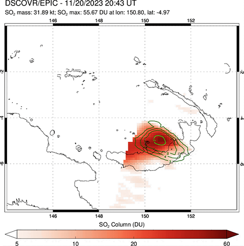
November 21, 2023
SO2 mass from the Ulawan eruption on 11/20 and 11/21 2023.
The green contours show airborne volcanic ash (VA) as qualitative UV Aerosol Index (1 to 10), which is proportional to ash concentration and height. Most of the VA falls out near the volcano, but some fine ash fraction is transported together with SO2 gas by upper tropospheric winds away from the volcano and poses a danger to aircraft.
Watch the Video
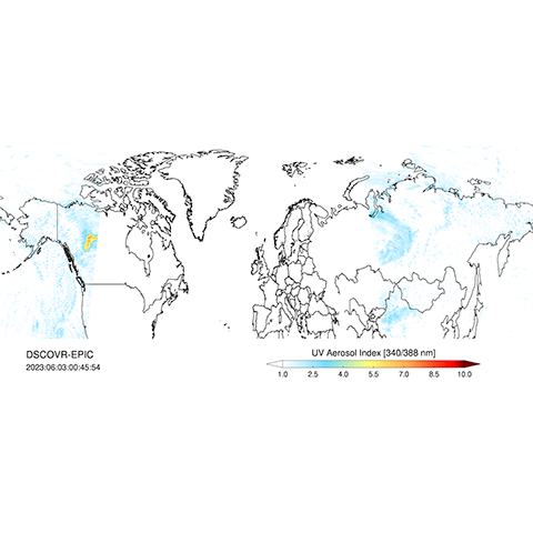
June 06, 2023
Transport of smoke Plume from Canadian wildfires over the periods of May 9 to 13 and June 3 to June 6, 2023 as detected by EPIC's UV Aerosol Index.
Watch the Videos

December 07, 2022
These images, captured by the EPIC instrument on the DSCOVR satellite, show the Earth 50 years after the famous "blue marble" photograph taken by the Apollo 17 mission in 1972. The “blue marble” photo, the first true-color image of the fully-illuminated Earth captured from space, became an iconic symbol of our planet and the environmental movement.
This set of images was taken starting on December 7th, 2022, at 7:39 UTC at 15-minute intervals, with the last image being at 10:39 UTC – the same time that the original “blue marble” photo was taken. The variation in the appearance of Africa is due to the different perspectives from which the images were taken: the Apollo image was taken much closer to the Earth, at 18,000 miles, so less of the disk was visible compared to EPIC’s view from almost a million miles away.
Watch the Video
View the Images

March 21, 2022
High time cadence (20 minutes) RGB images of Earth on March 21, 2022 during the Spring equinox.
Watch the Videos
View the Images

December 04, 2021
On Dec. 4, 2021, EPIC imaged a rare total solar eclipse in Antarctica from 1 million miles away. Click to see the full sized image.

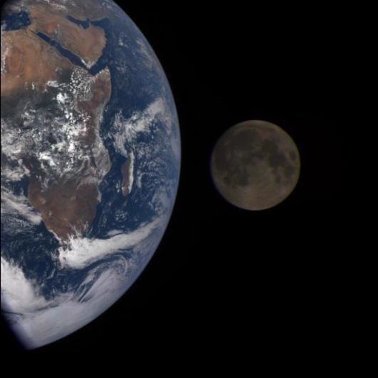
February 11, 2021
On February 11th, 2021, the moon again passed between DSCOVR and the Earth. EPIC snapped these images over a period of about 3 hours. In this set, the far side of the moon, which is never seen from Earth, passes by. In the backdrop, Earth rotates over Australia and the Pacific, gradually revealing Asia.
Watch the Video
View the Images

October 02, 2020
On October 02, 2020, DSCOVR caught the moon passing behind Earth. EPIC snapped these images over a period of about 6 hours.
Watch the Video
View the Images
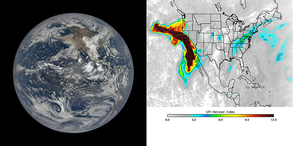
September 12, 2020
Visible-light and ultraviolet images show the progression of the smoke from the historic wildfires on the west coast of the United States from Sept. 9–12.
View the Images

June 21, 2020
On June 21, 2020, DSCOVR EPIC captured an annular solar eclipse over Asia.
View the Images

April 21, 2018
Panel 1: On April 21st, 2018, DSCOVR EPIC observed a bright glint from the smooth water surface at the Arabian Sea. Panel 2: On July 4, 2018, DSCOVR EPIC captured a sun glint from ice clouds over Mexico. Panel 3: On August 5, 2018, DSCOVR EPIC observed a sun glint from ice clouds over Thailand. Panel 4: On September 9, 2018, DSCOVR EPIC captured a sun glint from ice clouds over South Sudan. The glints appear blue on the east side and red on the west side because EPIC uses a filter wheel and captures the red component of the image slightly later than the blue component—and during the time in between, the Earth’s rotation shifts the position of the glint to the west. (See Fig. 6 at https://epic.gsfc.nasa.gov/about/epic for an image of EPIC’s filter wheel.)
View the Images

August 21, 2017
On August 21st, 2017, DSCOVR EPIC captured a total solar eclipse over North America.
Watch the Video
View the Images
May 15, 2017
Parked in space a million miles from Earth, the Earth Polychromatic Imaging Camera (EPIC) onboard the Deep Space Climate Observatory (DSCOVR) captures glimmers of reflected sunlight, evidence of ice crystals in the atmosphere.
Watch the Video

February 26, 2017
On February 26th, 2017, DSCOVR EPIC captured an annular solar eclipse over South America.
View the Images

July 05, 2016
July 05, 2016. On July 5th, 2016, the moon again passed between DSCOVR and the Earth. EPIC snapped these images over a period of about 4 hours. In this set, the far side of the moon, which is never seen from Earth, passes by. In the backdrop, Earth rotates, starting with the Australia and Pacific and gradually revealing Asia and Africa.
Watch the Video
View the Images

March 15, 2016
On March 15, 2016, over a span of 5 hours, DSCOVR EPIC imaged Jupiter. This activity was done for purposes of instrument characterization, but also provides a unique view of our solar system's largest planet and its moons. Because of the long time span and the techniques required to do the imaging, it was not possible to do regular color images. Instead, the color information was extracted from the relevant bands and applied to the 443nm (blue) channel in order to provide the colorized rendition. Below is the labeled version of the colorized 443nm band, the original 443nm band, and the unlabeled colorized 443nm band.
View the Images

March 09, 2016
A total solar eclipse starting on March 9 00:15 UTC and ending on March 9 03:38 UTC was visible only from the South Pacific. The DSCOVR EPIC camera was following the shadow cast by the moon on Earth during this time from its vantage point at the Sun-Earth first Lagrange point. Note that the total eclipse is limited to the center black area of the shadow. The outer regions experienced a partial eclipse with a portion of the sun’s disk always visible. Hence some surface features and clouds can be identified.
Watch the Video
View the Images
September 27, 2015
Video of the lunar occlusion event as captured by NASA’s Earth Polychromatic Imaging Camera (EPIC).
Watch the Video

July 16, 2015
Reprocessed images and movie of the transit of the moon in front of the full sunlit disk of Earth captured by NASA’s Earth Polychromatic Imaging Camera (EPIC) on board NOAA’s Deep Space Climate Observatory (DSCOVR) on July 16, 2015. The transit lasted from 16:30 EDT to 20:10 EDT. Since DSCOVR is not exactly on the Sun-Earth line, this event is not a solar eclipse.
Watch the Video
View the Images

July 06, 2015
Reprocessed version of the first light image of North and Central America made by the DSCOVR EPIC camera on July 6, 2015. Clouds cover most of the hemisphere. The central turquoise areas are shallow seas around the Caribbean islands. The brighter circular area in the image’s center is caused by sun light reflected from the ocean surface (sun glint).